Not having Internet is stupid! We can’t take care of any business, and being on the road means almost all business is virtual. We can’t check our weather apps. We can’t route plan or research locations. I can’t send Good Morning pictures on Instagram. I can’t look up the best way to remove a great deal of olive oil from my shirt and favorite hiking pants when the lid on the salad dressing flies off mid-shake. Worst of all, I CAN’T BLOG.
Thus I am behind on my own self-imposed posting schedule. I’m also really, really behind on laundry but that’s about not having a different kind of connection, depending on your view of the Internet. It is largely deprivation by choice, so without further complaining, let’s go see why we were living in a hole.
PALO DURO CANYON S.P.
We have been in Texas for the last two weeks, and it looks like we will stay in Texas for most of the rest of the year. Our first stop was at a free city park in Hereford that offered water and electric, was within walking distance to stores, and had over-the-air television (OATV) but it was noisy at night with constant train whistles and nearby traffic. The price was right, though, and we needed to bridge a few days until our next site at Palo Duro.
 |
| Our next site at Palo Duro |
We drove the vehicles separately since it was only an hour’s drive, and given the road down into the canyon, that was a very good thing. I would not have survived the terror of being in the RV on that road.
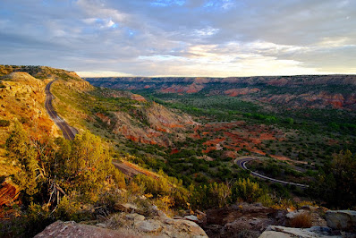 |
| View of Nope! Road |
This canyon is the second biggest in the U.S., which is why, once you’re in it, you will have gorgeous scenery but no cell or internet service whatsoever.
We hurried and got out on a trail walk while there was still a bit of sun and warm weather because snow (!) was predicted for the coming weekend. You read that right.
While the temps did plummet overnight, neither frost nor snow materialized, so we suited up and headed out for a hike.
 |
| Too cold for horny toads. |
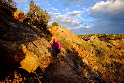
Even though the sun shunned us, the canyon was still pretty.
 |
| Kaleidoscope of color |
The trail was relatively easy, with little gain, but due to some recent flooding in the canyon and a heads-up from a mud-covered passing hiker, we stayed on the southwest side of the canyon floor to avoid the quagmire, making our hike a 5.4 mile out-and-back instead of the longer loop we’d originally planned.
 |
| Less-muddy cliff side. |
We had fun keeping warm by timing ourselves between some of them, trying to keep a respectable pace.
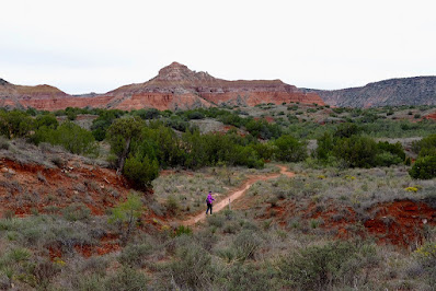 |
| Happy to be snow- and mud-free! |
Twice daily I visited the nearby bird blind. I would’ve dearly loved to have seen a Painted Bunting or a Blue Grosbeak, but they’d already passed through for the year.
 |
| “What do you have against red birds?” |
I logged the birds I did spot into the logbook which included other enlightening entries such as “Bird” “Sparrow” and “Joe B is a liar and a cheat.”
 |
| “Joe B? No one here by that name.” |
We were up before the sun, noticing that the skies were clear and full of stars, contrary to the forecast. That meant we bundled up and hurried out to catch the trail up to Goodnight Peak, named for a person not because it’s a good place to see the sunset which I foolishly thought at first.
 |
| Blurry because it was dark out and I don’t mess with camera settings. |
The sunlight was no match for the cold wind, but the climbing was.
The forecast indicated that the following day would be the best for any more hiking, so we planned an ambitious loop route, combining three trails, in order to take in the most scenery possible.
 |
| Someone in this photo is over-dressed. |
The description of this trail on the park map expands on these warnings with further words of wisdom, “Do take plenty of water, as most heat-related injuries and deaths to people and pets occur on this trail.” Sweet!

We began with the Lighthouse Trail to the “symbol of Palo Duro Canyon State Park.”
 |
| Too bad for you! |
Next we connected to the GSL trail.

It was a pretty trail and the most treed part of our hike.
 |
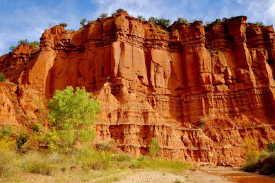
| Cottonwood Flats area |
 |
| a.k.a. The River Walk |
 I
I |
| May I have this dance? |
Fabulous Fun Fact® ta·ran·tu·la /təˈran(t)SHələ/ 2. a large black wolf spider of southern Europe whose bite was formerly believed to cause tarantism /ˈterənˌtizəm/ a psychological illness characterized by an extreme impulse to dance, prevalent in southern Italy from the 15th to the 17th century, and widely believed at the time to have been caused by the bite of a tarantula.
That evening, we befriended our neighbors who travel full-time in their Newmar Ventana. People with similar rigs tend to naturally flock together, and we’d been parked across from one another for the past few days. We had fun talking over other similar interests, checking out the inside of one another’s coaches, and exchanging info so that we can stay virtually connected in the hopes of connecting face-to-face in the future. They said they’d noticed our TV antenna up and discovered the reception the same way we had. They also alerted us to where they’d seen the park’s Barbary Sheep, and though we looked and looked for the remainder of our stay, we never did see them.
The tale of this stay ends rather uneventfully since our last full day was a very rainy one. We drove up to the entrance gate parking area – the only place in the park with reliable connectivity – to make a few calls and try to catch a glimpse of one of the three Texas Longhorns that live at the park. We’d each seen one one time each and were hoping to see one one more time. They must have been off wherever the sheep were hiding because we saw neither Biscuits nor Gravy or The Third One.
I hate to leave you with such a soggy ending, so let’s reflect on the good times.

CAPROCK CANYONS S.P.
Our next destination was less than 100 miles away near a town named Quitaque – how do you think it’s pronounced? My guess was Ki-tah’-kee, but I was delighted to learn it is Kitty Quay! Another canyon, a teeny bit of Internet but very unreliable and completely frustrating, phone reception that was best if we stood on the picnic table, and plenty of OATV. No matter, though, the weather was delicious and there was plenty of footwork to be done.
This park houses the Texas State Bison Herd, and they roam freely throughout the whole park. Guess what I’m going to say next? You got it! We were bison-blocked on our very first walkabout! We backtracked to avoid any confrontation, then only a few minutes after we were back at the rig, what appeared to be the whole herd did this
 |
| View from the passenger seat |
When they’re not threatening to gore you, they’re fun to watch rolling in the dirt and scratching on every post and sign.
One of them escorted us part of the way to the trail head the following morning.
 |
| Lead on, Oldster! |
Destination hikes are my favorite, doubly so if they’re loops, and there were three ways to choose to get to Fern Cave, all of them possible loops! The map showed that small sections of each way were labeled “extremely steep & rugged” and we didn’t trust in that quite as much as we probably should have.
It began with a gorgeous day.
Does this look like a trail? No, no it does not.
The only way I could get to the top was to simply not look behind me at any point and only focus on spotting each trail marker. TBG was my calm voice of encouragement. We passed two much younger couples, who had limber youth on their side but were happy to follow our trail-navigating experience.
I was never so happy to get to the top of a trail, and I tried not to think about either having to go back down that or encountering something even worse on one of the other choices. Soon we were at the sign indicating that Fern Cave was a mere .25 miles further.
Further down, that is.
 |
| Much steeper than it looks. |
We both voiced our expectation that this Fern Cave thing better be worth it.
Being a Saturday, we had to share the cave with a few other hikers.
The first part of the trail was supposed to be more of the “extremely steep & rugged” stuff, but it was not at all. That is why it’s hard to trust the park maps! It followed an old stream bed, but soon opened up.
 |
| More of the trail-machine’s work. |
 |
| Some of it wasn’t the most scenic. |
 |
Spotted Whiptail Lizard says, “Don’t insult my home!” |
 |
| Some of it was. |
We never did run across that bison, but we followed his tracks almost the whole way back, right down the middle of the trail. Seems the bison are appreciative of the cut trails, too. In order to get back to where we’d parked, our last mile was along the roadway, making our total for the day just over seven miles.
Our next hike was on the Eagle Point trail to find the natural bridge.
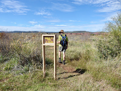 |
| TBG said there would be a better sign later. |
 |
| Lone Aspen shining like a beacon. |
 |
| No, thank you. |
 |
I’ll stay up here. |
 |
| A better sign |
 |
| Canyon namesake |
Our last real hike at this location was another seven mile combo.
 |
| a.k.a. Wild Horse Trail |
About three-quarters of a mile in, we looked down and saw this
 |
| Bison-blocked AGAIN! |
 |
| Connecting to the Mesa Trail. |
 |
| Gopher Snake |
 |
| Descending from the mesa. |
We had planned an out-and-back portion of the Upper Prong Trail, and our friends from earlier helped us decide when it was a good time to start the back portion.
 |
| Sneak around us once? Shame on us! Sneak around us twice? Stomp on you! |
 |
| Woodhouse’s Toad |
 |
If it hadn’t been walking across the trail right in front of me, I never would have seen it. Do you see it? |


